
When a utility is faced with a natural disaster, tools such as an outage management system and distribution management system are traditionally leveraged to get service back up as quickly as possible. But as electric utilities confront disasters that impact increasingly larger and denser populations – from Hurricane Sandy to California wildfires – its natural disaster management plan cannot begin the first day after the danger has passed: The urgent need to repair critical infrastructure and deliver power to customers is too great. Instead, the plan should first identify the resources a utility needs to forecast the disaster, prepare the network and customers for the impacts, and resolve outages and damage as quickly as possible.
In fact, more and more utilities are leveraging tools not typically used in outage scenarios to comprehensively protect customers and infrastructure better, and to work with first-response crews and governmental agencies to speed up recovery. This article will examine how two of the most prominent systems – GIS and weather forecasting technology – can work together to prepare the network for a disaster and recover in the aftermath.
More than maps
A GIS system provides one of the most important tools a utility needs when responding to a major disaster: enterprise-wide access to readily available, highly accurate mapping and data on real-time asset conditions. This becomes even more critical as an increasing number of utility workers retire from the workforce and with them decades of data including the thorough and historical understanding of the network and its risk points, walk out the door. This information may never have been captured digitally, but instead remains in the brains of a talented workforce or locked away on paper, with no efficient or systematic way of transferring the accumulated years of intuitive knowledge.
With an enterprise GIS system, information can be updated across the entire organization immediately. This is imperative not only for day-to-day operations, but especially when preparing for and responding to natural disasters. For example, as hurricanes, fires, floods or other weather events approach a city, utilities can leverage their GIS to assess the risk to critical infrastructure and prepare for damage-related outages, as well as communicate with customers to help them prepare for extended outages and keep them informed on the progress of the restoration. Service can be adjusted to avoid added risk from damaged assets. These shutoffs can be isolated to minimize the number of affected customers because of the accuracy of the database and advanced network analysis tools. Similarly, the real-time data allows the utility to know where it can quickly restore service or how to reroute services around damaged assets in the meantime to keep the lights, gas, internet, and water on.
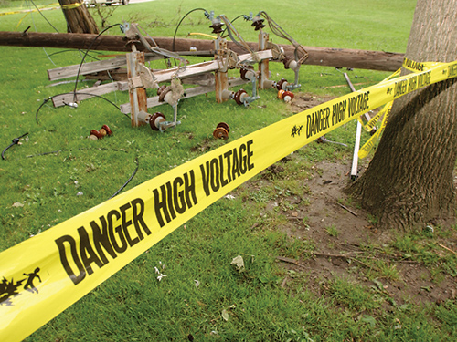
The mapping and asset identification benefits of the GIS system are just as important after a disaster hits. For instance, if a plane or helicopter is surveying damage overhead and spots a downed utility pole, the GIS can tell the worker the size and type of the pole, what equipment is on it and how customers downstream may be affected by the damage. This is powerful information for a utility working hard to reroute or reconfigure the network to get customers back online, or at least manage expectations as to when reliable power is running again.
Enterprise GIS helps utilities prepare for and respond to major disasters by
ensuring data is both highly accurate and easy to rapidly share
This asset data is also important for damage assessment by helping to determine the amount of material lost and the associated cost. A utility can compare the needs to the materials it already has in stock to get things back up and running, or make a specific request of nearby utilities.
Enterprise GIS was a valuable resource to many utilities during the aftermath of Hurricane Sandy, when millions of customers were left without power. Several utilities provided outage maps on their websites, and some even had them up and running before Sandy hit. This allowed their customers to prepare and plan for their expected days without service.
Many utilities, however, never provided this information and were criticized by the government and the public for being unprepared.
As John Wycoff, director of engineering at New Jersey Natural Gas, stated, “After our dedicated employees, the biggest reason we were able to restore service so quickly was our GIS system and Schneider Electric’s ArcFM. A typical outage could be a hundred homes and a few thousand feet of main. Here we were facing 30,000 homes and over 275 miles of main. Without these tools to analyze and manage the restoration process, we could never have responded so quickly.”
Forecasting disaster
Adequately preparing for a natural disaster is just as important as the response to it. Utilities need to know where and when damaging weather conditions will impact their territory to execute a faster response to service interruptions. The right forecasting service will provide reliable, precise weather data – including real-time lightning detection and customizable alerts – to help utilities prepare and restore power more quickly after a disaster. To help pre-position crews, predictions may show a color-coded threat level to the service territory for the next 60 minutes, and storm tracking will display the storm’s estimated arrival times to a utility’s assets in its path.
This helps utilities plan ahead, ensure enough crews are mobilized, and position them properly with equipment already set up and ready to respond to the predicted damage. For example, real-time, animated lightning strikes can pinpoint where assets may be in danger and instantly let operators know whether the strikes are intensifying or subsiding. If the weather forecasting service has high-resolution, street-level mapping, it can work with the GIS system to provide the ultimate view of conditions and how the weather is affecting key infrastructure to help operators make better-informed decisions about response crews and operations.
In the event of a natural disaster, such as a hurricane, a utility needs to have the best forecasting expertise at its fingertips to determine exact landfall location, expected precipitation, wind speeds, and more. With a top-rated weather forecasting service, a utility may be able to procure the resources it needs more quickly, including mobilizing additional field crews and preparing surrounding utilities to help. The forecasting service should include long-range forecasts and hourly ones that include a confidence ranking to help operators prioritize resources for the response. Prioritizing is key when preparing for a disaster to ensure that extra resources aren’t wasting time and money where they are not needed.
After Hurricane Sandy, Tom Murphy, environmental compliance and business continuity manager for Unitil, a public utility holding company, noted, “It is possible to over prepare for a storm…By not listening to some of the hype, we avoided over-preparing, which is ultimately a cost-benefit to our customers.”
More utilities are taking weather forecasting one step further by integrating historic weather data with their GIS, giving them predictive outage management scenarios and plans. If extreme weather events are more common in certain months or regions of the service area, the utility can better prepare in terms of staffing and infrastructure development. This is where the importance of weather forecasting comes in and where the combination of it and the GIS data can be the most powerful.
Collaboration during disaster
The combination of accurate weather forecasts and a GIS system can also be a tremendous asset to the greater community. Utilities may share data with fire authorities, emergency management groups, and public officials who assist them in planning and response. With large-scale disasters that require public safety crews to assess large numbers of threats, this data can be an indispensable tool for helping decision-makers triage the most critical areas and deploy resources.
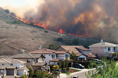
An example of this occurred several years ago in San Diego as fires invaded the area. First responders were able to create maps of essential infrastructure with the local utility’s GIS information. As fires approached a primary communication tower, a hub for all the main cellular carriers in the area, it threatened the communications network that all emergency responders were using. With the help of the GIS mapping service, responders were able to redeploy and prevent the loss of the tower that was essential to the ongoing disaster management effort.
Utilities can be an integral partner for public safety officials and first
responders by sharing data to assist in planning response
Real-time data is also used in the event that crews from surrounding utilities are called to the area to help with recovery. When faced with lines of trucks and crews waiting for directions, a utility must be able to disseminate information quickly and accurately to maximize the extra resources. With the asset information from a GIS system and the real-time weather conditions and forecasts available in the back office and out in the field, additional service crews can quickly become part of the team and get to work on outage restoration.
Accessibility during the storm
Weather forecasting and GIS data is not as valuable if crews can’t access it during a disaster because communications infrastructure is damaged or overloaded. Now more than ever, utilities are working to ensure that crews can access the GIS database via a mobile device, as well as record and update data safely and securely.
A variety of solutions are in production to provide alternative ways for field crews to access and record data, including greater use of mobile devices and developing cloud-based systems for uploads and downloads. Workers are now able to access and upload data wherever they can connect to a wireless internet or mobile network. This increases the security of data and the efficiency of crews by reducing the number of truck rolls to report in and collect new data and assignments. A flexible field crew can stay in the field and respond to new jobs as they come in. This is a huge advantage during disaster response – when every minute counts.
As these systems become increasingly integrated, customized and shared, utilities will innovate ways to use the advantages to meet their business challenges. Of all the significant benefits enterprise GIS brings to a utility, hopefully the job of disaster management is rarely needed. But when billions of dollars in infrastructure, hundreds of thousands of customers, homes, and businesses are at risk, the ability to aid in effective and rapid response is critical.
What’s next?
Natural disasters will only have greater impacts as our population continues to grow, especially in urban areas. By further analyzing historic weather events, utilities’ outage management can take more predictive elements into consideration. For example, by looking at previous hurricanes on the East Coast and where the highest winds have been, utilities can overlay that information with their most exposed infrastructure and predict not only where the next storm may have the greatest impact on infrastructure but where proactive measures can be taken, such as vegetation management or replacing older poles in these targeted areas.
As utilities examine all of their resources when preparing and planning a natural disaster response, enterprise-wide systems with real-time information, like GIS and weather conditions, will likely always play a central role. As the industry moves to integrate more systems and more historical data, our picture of the past will not only become clearer, but so will our path ahead for faster service and restoration after the storm.
About the author
 Danny Petrecca is currently Director of Product Management for Enterprise GIS at Schneider Electric. He has a deep knowledge and experience with application of GIS technology to utility and communications industry business needs. His specialty is graphic work design in utilities. Danny has 13 years of experience in the geospatial industry.