
Electric utilities face unprecedented challenges in today's dynamic and quickly evolving energy landscape. Navigating the complexities of adapting to changing regulations and standards, exceeding higher consumer expectations, upgrading legacy IT systems and aging infrastructure, addressing technology constraints, meeting the ever-increasing demand for energy, confronting extreme weather patterns and moving away from fossil fuel sources, all while delivering reliable and affordable electric service, present utilities with an array of hurdles.
In response to these daunting obstacles, utilities are investing in grid modernization, transitioning to renewable energy sources, focusing on effectively navigating regulatory pressures, and engaging with customers in new ways.

GIS technology can eliminate reliance on paper processes.
Image credit: Epoch Solutions Group
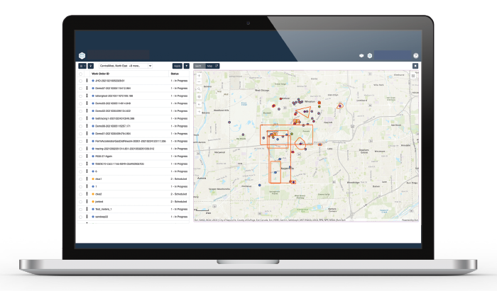
Utilities can schedule and dispatch resources easily with GIS-enabled workforce automation.
Image credit: Epoch Solutions Group
Transforming key business processes through GIS technology
Most utilities are also adopting innovative technologies such as geographic information system (GIS) technology. They recognize that GIS extends far beyond maps and can help them effectively manage their infrastructure while transforming key business processes.
GIS technology enables utilities to visualize, analyze and interpret spatial data, such as the locations of infrastructure assets, land use patterns and environmental factors. It helps them identify locations and events that are static and don’t change over time, such as where an existing building is on a property or the site of a previous power outage. GIS can also track dynamic locations and events, like the spread of wildfires or rising flood waters.
GIS technology eliminates the need to plot routes on traditional paper maps, locate specific assets through manual searches, or rely on an individual’s memory. Furthermore, GIS technology greatly assists field workers by digitizing the process of recording asset inspections and infrastructure data. This shift from paper-based recording not only saves time but also reduces the likelihood of data entry errors.
By ensuring that both field workers and office staff have access to the same authoritative, up-to-date data, GIS technology fosters a more cohesive and efficient working environment.
The most sophisticated solutions on the market today display utility company geospatial data digitally via interactive maps. Utilities receive real-time information to make informed decisions, such as whether to monitor an asset’s condition, manage vegetation more often, or respond to an outage.
Ensuring effective asset management
In many cases, GIS technology allows users to drill down on pertinent details about assets, including the manufacturer, age, current condition, inspection history, projected remaining useful life and more. This data lets utilities know whether an asset needs to be inspected, serviced, or repaired, thus reducing asset breakdowns, preventing network disruptions and enhancing asset lifespan.
Driving field services efficiency
Managing utility field services is a highly complex endeavor. Coordinating field crew workers and equipment across vast utility service areas requires teams of administrators, timely access to field data, volumes of paperwork, and the industry’s most advanced high-performance computing systems. While routine inspections and maintenance work can be planned in advance, outages occur unpredictably, disrupting field crew operations and impacting the lives and businesses of customers throughout the community.
When outages occur due to storms or unforeseen incidents, such as a worker accidentally cutting a line, GIS technology with integrated GPS tracking proves more efficient than manual data collection. Utilities can employ GIS-enabled dashboards for quick and visual identification of outages, crews and work sites. Rapid location of these elements streamlines damage assessment and repair prioritization, significantly improving field crew response efficiency.
If the GIS technology is integrated with an advanced workforce automation tool, the utility can assemble and deploy large groups of field crews to repair and restore outages using real-time data displayed on maps and graphs. Many solutions enable field crews to use their mobile devices to access work orders either online or offline, send and receive information from the back office and electronically sync data with the back-office enterprise systems.
Because GIS technology provides situational awareness, utilities can also optimize crew deployment for such non-urgent tasks as managing vegetation and inspecting power lines, gas lines, cell towers and other assets—ensuring safety, complying with rapidly evolving regulations and gaining full asset traceability.
Leveraging multiple GIS technology solutions
In today's dynamic utility landscape, if a utility is already leveraging GIS technology, seamless GIS data integration is vital. It’s crucial to be able to visualize geospatial data across systems within the organization. If multiple GIS systems are in use, integration requires flexible mappings that support sync between different data models, a plugin architecture for easily deploying custom data format connectors and transforms and incremental data synchronization that ensures only data changes are synchronized.
In numerous cases, utilities that implemented a foundational, robust GIS technology solution years ago — such as GE Smallworld — now also seek the advanced tools and technologies available in the Esri environment.
- GE Digital Smallworld - GE Digital Smallworld highlights that it streamlines design and data capture workflows to ensure the accuracy and completeness of utility network representation, from planning through operations and maintenance for the end-to-end asset lifecycle. It also enables multiple users to make concurrent changes through singular versions and allows for a coordinated convergence of the changes back into the master in any order demanded by the business process.
- Esri ArcGIS Utility Network - The Esri ArcGIS Utility Network (UN) is designed to be a spatial information system that provides greater functionality “over massive datasets at every resolution scale.” ArcGIS Utility Network states it is configurable for any utility, municipality, or organization with linear assets.
Utilities leveraging a GIS system of record often desire to migrate data to Esri UN as their system of engagement. They seek a solution that allows their end users to log in through a single portal and access several different geographic datasets, regardless of the data’s origin, and desire minimal requirements for manual intervention and limited ongoing management.
BC Hydro challenge: limited ability to work with GIS data
For BC?Hydro, generating and delivering electricity to 95% of the population of British Columbia, Canada, involves 30 hydroelectric plants and a network of more than 80,000 kilometers of power lines that transport power across a varied terrain. Ensuring reliable service to more than five million customers in this demanding environment requires ready access to robust GIS data.
Since the utility’s GIS information for transmission and distribution resided in GE Smallworld, the organization sought more tools to work with that data effectively.
“Other business groups in the company, like our power generation group, were using Esri for GIS data,” noted IT Advisor Evan Schwab. “While we currently have two GIS systems, we’re looking to develop new capabilities on the Esri platform going forward.”
Two factors provided a strong impetus for getting BC Hydro’s GIS data accessible on Esri:
- In the short term, the utility wanted to move to a web-based, map-based application for managing its many environmental documents, with reference layers for the transmission and distribution functions. “Because we were going with a web-based application for our new environmental solution, we had to have the data in an Esri format,” Schwab said.
- In the long term, BC Hydro saw more and more applications eventually moving to Esri. As the organization rolled out other Esri-based solutions, including an emergency operations dashboard and a street light management system, the utility envisioned benefits from an enterprise view of its transmission and distribution data in an Esri format.
The solution: migrate GE Smallworld data to Esri
BC Hydro sought a third-party GIS data migration software solution to sync its GIS data between GE Smallworld and Esri. It found a dedicated solution purpose-built for data synchronization between Smallworld Version Managed Data Stores and Esri ArcGIS Enterprise Geodatabases.
In 2020, it implemented the software, which involved an initial full synchronization of the data between Smallworld and Esri. Once implemented, the solution only needed to perform periodic data synchronizations, ensuring just the incremental data changes were synced. In early 2023, BC Hydro implemented the latest version of the third-party solution that supported Esri’s latest ArcGIS Pro SDK and support for the Esri UN.
“We needed to be sure we could continue to use this product long term, staying ahead of any software compatibility issues,” Schwab explained.
The results: simple synchronization, better access
Schwab describes the third-party solution as “a simple tool that works great,” specifically citing its ease of use. “The phrase we use is ‘set it and forget it.’ We set up an interface and now it just runs every night and does what it’s supposed to do.”
BC Hydro’s in-house research team can easily make any data model changes. And, with the seamless migration of GE Smallworld data to the Esri environment, the utility has gained powerful advantages.
“We’re leveraging ‘no-code tools’ like ArcGIS Story Maps to develop planning for maps for distribution,” Schwab said, eliminating the need for planners to rely on PDFs and essentially start from scratch anytime they needed to create a map. BC Hydro’s planning maps communicate key details to senior leaders and the Distribution Engineering and Design group, such as low capacity issues and upcoming system improvement work.
The utility can now embed maps into off-the-shelf tools like Collector, Field Maps and SAP Service and Asset Manager, providing its field personnel with the up-to-date information they need to complete their work effectively.
“We’re leveraging a number of software developer kits for Esri to embed maps in web applications for street light management, customer connection requests and environmental study tracking,” Schwab said.
BC Hydro can also share GIS data with external groups—like Emergency Operations BC—to ensure everyone has much-needed situational awareness when major events occur.
Opportunities abound: GIS technology moving forward
For decades, utilities have relied on manual processes to collect data in the field, transfer it to central databases, and issue work orders, as well as dispatch instructions and master schedules for their field operations.
Today, these labor-intensive processes are no longer sustainable. As populations increase, infrastructure assets age and regulatory standards become more stringent, utilities must leverage GIS technology to keep pace with advancing field asset management demands. By integrating GIS technology with automated workflows, they can meet their operational demands as well.
Simultaneously, the benefits of an enterprise-wide solution that provides seamless GIS data integration between multiple platforms are vital. The ability to share real-time data throughout the utility’s geographic area enables more detailed and accurate tracking of asset conditions, which leads to timely inspections, servicing and repairs. And visualizing spatial information in a digital format also allows for better, more precise predictive models. It empowers utilities to effectively manage thousands of field workers responsible for maintaining power grids and orchestrating efficient and effective disaster responses.
With access to detailed, dynamically updated infrastructure maps and data, utilities can project the time and costs involved with field operations more accurately, restore services faster and reduce environmental impacts along the way.
With the ability to aggregate and share data in real-time, utilities can respond more strategically when emergencies strike, getting workers to critical areas faster so they can repair assets, mitigate damages and quickly restore services for impacted communities.
GIS technology provides a powerful tool for spatial analysis, asset management, emergency response, resource allocation and efficient and informed decision-making. By employing a singular GIS technology or synchronized solutions that are integrated with advanced workflow management tools, utilities will be able to meet the current challenges head-on and thrive for years to come.

James Street is the founder and Chief Executive Officer of Epoch Solutions Group, a map-first leading provider of mobile workforce management software for utilities and data synchronization capabilities.